A break in Wisconsin weather has given us the opportunity to turn our eyes on the tropical storm developing into a hurricane in the gulf coast. Currently it has maximum sustained winds of 60 mph which put it in the tropical storm category. Strengthening is expected in the next 36 to 48 hours which will bring the storm into hurricane criteria of 80-90 mph. By 2 pm wednesday the Hurricane is forecasted to have 100 mph winds pushing it to a category 2 hurricane, Believe it or not one category below what struck the same shore in 2005. Yesterday the storm tracks that the models produced, veered the stormed closer to making land fall towards the Louisiana coast. Below is an image of several model tracks, although there is that single white line doing its own thing you can see that most of the models are beginning to agree on the predicted track.
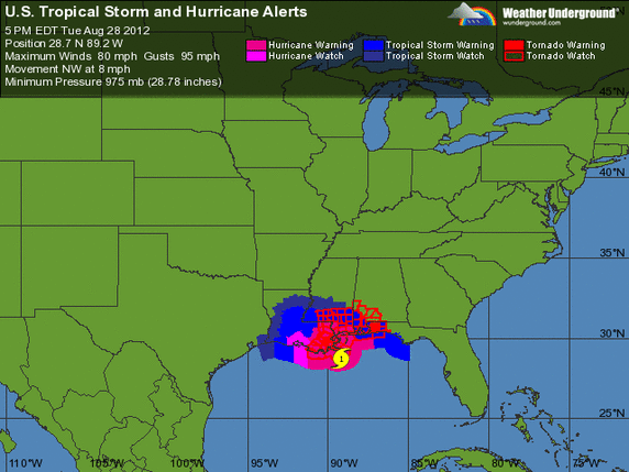
Below is another image of the gulf coast showing this time the current weather advisories that have been issued ahead of this Tropical storm expected to become a hurricane and a forecasted storm surge of 6-12 feet.
 RSS Feed
